The Fantastic in Art & Fiction – Sponsored by Cornell University’s Institute for Digital Collections (CIDC) this image-bank provides a visual resource for the study of the Fantastic or of the supernatural in fiction and in art.
A History of the World – The British Museum and BBC uses objects to tell a history of the world.
Shooting in a Dust Storm – Cameraman Bob Poole was filming elephants with ease — until a giant dust storm rose up and swallowed all the light.
Wikiquote – the free quote compendium that anyone can edit.
HHMI’s Virtual Museum – Stroll through exhibits on biological clocks, infectious diseases, cardiology, and neuroscience at the Howard Hughes Medical Institute’s online museum.
List of Colors – a comprehensive list of colors at Wikipedia.
Image Searches – for use with blogs, web pages, etc. (make sure to check for creative commons license or other conditions – images posted on line are NOT free for the taking just because they’ve been posted.
Compfight is an image search engine tailored to efficiently locate images for blogs, comps, inspiration, and research. We make good use of the flickr™ API, but aren’t affiliated with flickr.
everystockphoto.com – search engine for free photos. These come from many sources and are license-specific.
Freerange Stock was formed with the goal to provide quality stock photos for commercial and non-commercial use. For free.
search.creativecommons.org is not a search engine, but rather offers convenient access to search services provided by other independent organizations.
In this case, Park Avenue is a canyon in Arches National Park. A 1 mile (1.6 km) trail leads through it between the Park Avenue parking area and the Courthouse Towers parking area.
Our September 27, 2011 hike started from and returned to the Court House Towers parking area, going up hill up the canyon and down hill on our return. We turned back at the steepest part of the trail, a short section from the Park Avenue viewpoint and trailhead.
Park Avenue viewpoint is the first major stop in the park after the visitor center.
Most visitors pass by Park Avenue trail on their way to other more popular features, stopping only at the viewpoints at either end to perhaps snap a few photos. We saw few other hikers on our “stroll” along the dry wash that passes between the towering walls of the canyon.
The Colorado and Green Rivers divide Canyonlands National Park into three districts – the Island in the Sky, the Needles, and the Maze, with the rivers themselves listed by the National Park Service as a fourth “district.” Island in the Sky is the easiest to visit and, thus, the most popular. The Maze is more remote and the least accessible of the park’s districts. The Needles is a 75 mile drive from Moab. Most of the district’s features are found on its extensive trail system and four-wheel-drive roads.
The road to the Needles district passes through Newspaper Rock Recreational Site, location of a large collection of prehistoric petroglyph rock art.
Most of our September 26, 2011 exploration of the Needles was on the relatively short scenic drive and the 2.4 mile Slickrock Trail (a loop).
Canyonlands National Park – A large region of rugged buttes, pinnacles, mesas and canyons south and west of Moab, Utah. This was the second time we’ve hiked this 2 mile round trip trail.
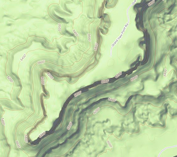
Grand View Point is the southernmost spot on the high mesa of Canyonlands, Island in the Sky. From the Grand View Overlook, the trail runs along the southern rim of the mesa, 1000 feet above the lower plateau, which is in turn carved into complex canyons by the convergence of the Green and Colorado Rivers.
On September 23, after we had moved from Devils Garden Campground in Arches National Park to a campground near Moab, we took a drive to see some some of the area that we had never been through before.
Heading northeast out of Moab on US 191, we turned left onto Utah 128 just before the bridge crossing the Colorado River.
Designated “Upper Colorado River Scenic Byway,” Utah 128 follows the Colorado River Gorge for over 30 miles, after which it crosses open desert towards Cisco. Now a ghost town, Cisco was established as a station for replenishing the water supply on steam locomotives on the Denver and Rio Grand Western Railroad main line. Five miles past Cisco, Utah 128 intersects Interstate 70.
For the first 13 miles, the highway parallels the river through a narrow section of the gorge – part of this distance, the gorge is part of the boundary for Arches National Park. The gorge widens after that, passing Castle and Professor Valleys, shooting locations for western films and television commercials. At 24.7 miles, a dirt road leads to a viewpoint for the red spires of Fisher Towers.
Our drive (blue) took us almost the full length of the scenic byway, including driving to the Fisher Towers viewpoint. We turned back just short of Cisco.
On the way back to Moab (red), we turned at the La Sal Mountain Loop Road, which is also the road into Castle Valley. While the road signs were less than optimum, we were able, with the help GPS, to take the right turns on the Forest Service roads. The road is paved part way.
The La Sal Mountain Range, in the Marti-La Sal National Forest, is the second highest range in Utah, with peaks approaching 13,000 feet. Pines, quaking aspens, and streams make this alpine region a sharp departure from the desert country around Moab just a few miles away.
PublicLibraries.com “strives to promote the use and support of local public libraries in every city across the United States.”
Archaeological Institute of America– “The AIA promotes a vivid and informed public interest in the cultures and civilizations of the past, supports archaeological research, fosters the sound professional practice of archaeology, advocates the preservation of the world’s archaeological heritage, and represents the discipline in the wider world.”
Lindsey Stirling – an American violinist, performance artist, and composer. In 2010 she competed on the fifth season of America’s Got Talent, reaching the quarterfinals. She has a large number of music videos available on her YouTube channel, which has nearly 200,000 subscribers. Since music videos can be heavily edited, I looked for a video of a live performance and found a performance at Scenra Theatre, in Washington, D.C.
SeedsNow.com – “All our seeds are 100% Non-Genetically Modified (Non-GMO), 100% Heirloom/Non-Hybrid, and 100% Open-Pollinated. This means you can actually save your seed year-after- year!”
Space Adventures – “the only company to have sent private citizens to space..,”
Cultivate – “a new online resource for kitchen inspiration and design.”
Our stay at Devils Garden Campground was for three days, but there was still more that we wanted to see in Arches National Park as well as other areas. On our 2007 trip, we had stayed 3 nights at the KOA southeast of Moab. This time, we decided to stay there again for four nights, extending our time in the area out to a full week. Driving distance was just 28.6 miles from Devils Garden to the KOA – the shortest distance between campgrounds we’ve done since September 2009.
Moab is the county seat for Grand County, which takes its name for the original name of the Colorado River, which runs north and west of town. The town’s population is around 5,000, with an economy largely based on tourism and outdoor adventure activities.
After Landscape Arch, we went see some of the sights nearer to the entrance to Arches National Park.
It’s 9 miles (14.5 km) from the park entrance to the Balanced Rock parking area. There are four viewpoints along the way for parking, viewing some of the park’s extraordinary and unusual formations and, at a couple of points, hiking.
Park Avenue viewpoint – trail leads downhill through the “Park Avenue” canyon to Courthouse Towers viewpoint.
La Sal Mountains viewpoint.
Courthouse Towers viewpoint – we hiked up the canyon from this point and back later in our visit.
Petrified Dunes viewpoint.
Balanced Rock is one of many popular rock formations in the park. From the parking lot, a short trail leads out to near the base and loops around it. The height of the pillar and rock on top is about 128 feet (39 m). The balancing rock is about the size of three school buses, estimated at 3577 tons. During the winter of ‘75 – ‘76 a smaller companion balanced rock fell. It had been called “Chip Off The Old Block.”




 For the first 13 miles, the highway parallels the river through a narrow section of the gorge – part of this distance, the gorge is part of the boundary for Arches National Park. The gorge widens after that, passing Castle and Professor Valleys, shooting locations for western films and television commercials. At 24.7 miles, a dirt road leads to a viewpoint for the red spires of Fisher Towers.

 Park Avenue viewpoint – trail leads downhill through the “Park Avenue” canyon to Courthouse Towers viewpoint.


